Manaslu Circuit Trek: Everything You Need to Know Before You Go

Manaslu Circuit Trek: Everything You Need to Know Before You Go
Most people who go to Nepal come back talking about Everest Base Camp or the Annapurna Circuit. A small group comes back talking about Manaslu and they talk about it differently. Quieter. More personal. Like they’ve seen something that most people haven’t found yet.
The Manaslu Circuit is a trek that goes all the way around Mount Manaslu, the eighth-highest mountain in the world at 8,163 meters. It follows the Budhi Gandaki River valley north through ancient Gurung and Tibetan-Buddhist villages, climbs into high mountain terrain, crosses the Larkya La Pass at 5,106 meters, and drops down into the Annapurna region on the other side. The whole loop covers about 177 kilometers and takes most trekkers 14 to 18 days.
Because it’s a restricted area, you need special permits to enter. That extra barrier keeps the crowds out. The trails here are quieter, the villages are more authentic, and the whole experience feels less like a busy tourist route and more like something genuinely remote. That’s exactly why people who do it can’t stop talking about it.
This guide covers everything you need to know before you go the route, the permits, the cost, the best time to go, what the trek actually feels like, and how to prepare for the toughest day on the trail.
Why the Manaslu Circuit Stands Apart
Nepal has dozens of great trekking routes. What makes Manaslu different is a combination of things that are hard to find in one place anywhere else.
First, the mountain itself. Manaslu means “Mountain of the Spirit” in Sanskrit, and it dominates the landscape in a way that feels different from other peaks. You don’t just see it once at the end of the trek. You walk alongside it for days, watching it shift from behind forest cover to open ridgelines to full, unobstructed views that stop people mid-step. At 8,163 meters, it is one of only 14 mountains in the world above 8,000 meters, and the Manaslu Circuit is the only trek that goes completely around it.
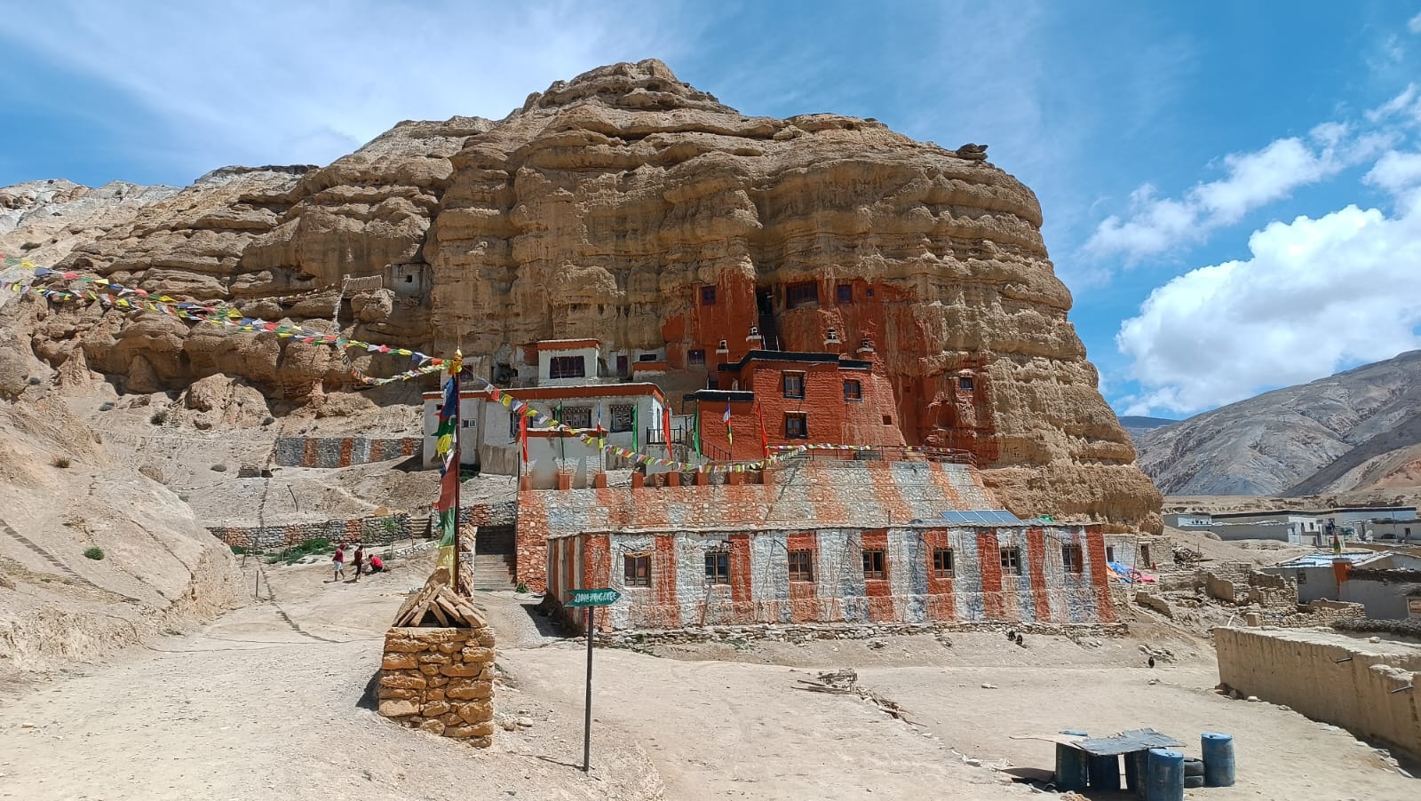
Second, the culture. The villages in the Nubri Valley, through which the main route passes, are Tibetan Buddhist communities that have been here for centuries. Monasteries, prayer wheels, mani walls, and chortens dot the route from early on. The further north you walk, the more the culture shifts away from lowland Nepal and toward something that looks and feels closer to Tibet. These communities are not set up as tourist attractions. They’re just real villages where real people live, and walking through them is one of the most genuine cultural experiences on any trek in Nepal.
Third, the quiet. The Everest Base Camp trail in peak season has the feel of a busy footpath. Manaslu does not. Because the permits are harder to get and the logistics are slightly more complicated, far fewer people come here. On many days on the upper circuit, trekkers encounter more yaks than other hikers. For people who find crowded trails frustrating, that difference matters a lot.
The Route
The trek starts in the lowlands at either Soti Khola (710 meters) or Machha Khola (900 meters), both accessible by a 9 to 10-hour drive from Kathmandu through Arughat Bazaar. From there, the trail follows the Budhi Gandaki River steadily north, gaining altitude through forests, river gorges, and increasingly dramatic landscapes.
The first few days pass through Gurung villages like Jagat, Philim, and Deng warm, green, and relatively low. These early days are not the hardest part of the trek, but they set a rhythm and give the body time to start adjusting to the days ahead. The forests here are thick, the river is loud, and the air still feels normal.
After Deng, the trail climbs through Namrung and Lho, where the views of Manaslu’s south face start appearing through gaps in the mountains. This is where most trekkers have their first real “oh” moment; the mountain just appears above the treeline, enormous and white, and suddenly the reason for all of this makes complete sense.
Samagaon, at 3,530 meters, is the main acclimatization village on the circuit. It sits in a wide, open valley beneath Manaslu’s north face and has a calm, almost meditative atmosphere. There is a Ribung Gompa monastery above the village worth the climb, and the Birendra Lake, a glacial lake at about 4,000 meters fed directly by Manaslu glacier meltwater makes for a perfect acclimatization walk. Most 14-day itineraries build in two nights here.
From Samagaon, the trail continues to Samdo (3,860 meters), the last significant village before the pass. Beyond Samdo is Dharmasala (also called Larkya Phedi), a collection of simple stone teahouses at 4,460 meters that serve one function: getting trekkers rested before the biggest day of the trek.
The Larkya La Pass
The Larkya La Pass crossing is what the whole trek builds toward, and it does not disappoint. Most trekkers leave Dharmasala between 3 and 4 in the morning to cross the pass while conditions are good. The first couple of hours are in total darkness, headlamps picking out the rocky trail as it climbs steadily across glacier moraine and frozen ground.
The pass itself sits at 5,106 meters. By the time trekkers reach it, usually around mid-morning, the sky is fully light and the panorama stretching out in every direction is genuinely difficult to process. Himlung Himal at 7,126 meters, Annapurna II at 7,937 meters, Cheo Himal, Kang Guru an entire wall of massive peaks, most of them with no other people in front of them. Prayer flags mark the highest point. Most trekkers stop for a while, not just because they need the rest, but because it takes a moment for the view to feel real.
The descent from Larkya La down to Bimtang (3,590 meters) takes another four to five hours. It is steep and the knees feel every meter of it. But Bimtang is one of the most beautiful campsites on the whole trek, a wide meadow ringed by mountains with Manaslu still visible to the north and most trekkers spend the night there feeling that they have just done something significant.
From Bimtang the trail descends through rhododendron forest and into the lower Marsyangdi valley, finishing at Dharapani, where the Manaslu Circuit joins the Annapurna Circuit trail. The last couple of days are gentler, but the change in scenery from high alpine to green valley is its own kind of reward.
The Tsum Valley: The Hidden Add-On
The Tsum Valley is a side route that branches off the main Manaslu Circuit in the lower section and adds roughly three to four days to the trip. Most people who know about it say it’s worth every extra day.
The Tsum Valley is a hidden Himalayan valley that was only opened to trekkers in 2008. It has its own permit (USD 35 per person per week), its own culture, and an atmosphere that feels even more remote and preserved than the main circuit. The people here are Tsumpa, a Tibetan Buddhist community whose history traces back hundreds of years. The monasteries, including the famous Mu Gompa, are among the oldest and least-visited in Nepal. For those with the time, this valley is the kind of place that changes what people think remote actually means.
Permits That You Need
The Manaslu Circuit requires three permits, and they all need to be arranged through a registered trekking agency in Kathmandu before the trek starts. The restricted area section begins at Jagat, and the checkpost there is strict.
- Manaslu Restricted Area Permit (RAP):
- Manaslu Conservation Area Permit (MCAP):
- Annapurna Conservation Area Permit (ACAP):
- Tsum Valley Permit (optional add-on):
The total permit cost for a standard 14-day circuit comes to roughly USD 125 to 150 per person, depending on season.
When To Go
The Manaslu Circuit has two main seasons. Autumn (October to November) is the most popular time and the best for clear skies. The air is dry, the views are sharp, and the weather is stable. Temperatures are cool but comfortable during the day and cold at night above 3,000 meters. October is the peak month teahouses fill up, but the trail never feels as crowded as Everest or Annapurna in the same season.
Spring (March to May) is the second-best option and many experienced trekkers prefer it. The rhododendron forests on the lower sections bloom in pink and red. The days are warmer, though cloud cover starts building in May as the pre-monsoon season approaches. Crossing Larkya La in spring is generally stable through April.
How Hard Is It?
The Manaslu Circuit is rated as a strenuous (Grade 4) trek. That rating is honest. This is not a route for first-time trekkers or people who are not comfortable with long days at high altitude. But it is also not technical climbing, no ropes, no mountaineering equipment, and no special skills required. What it does require is physical fitness, mental toughness, and a genuine respect for altitude.
The toughest single day is the Larkya La crossing. Trekkers start in the dark, walk for 8 to 10 hours, gain over 600 meters of elevation before the pass, and then descend over 1,500 meters on the other side. The altitude at the pass is 5,106 meters. Some people feel the thin air sharply. Others cope better. But nobody finds it easy, and that’s part of what makes arriving at Bimtang that evening feel so good.
The rest of the trek is demanding but manageable for anyone with reasonable fitness and proper preparation. The daily walking time ranges from 4 to 8 hours. The longest sections follow river valleys where the trail is straightforward but long. The steepest sections come near the pass and on the descent.
Altitude and Acclimatization
The Manaslu Circuit starts low (around 700–900 meters) and reaches 5,106 meters at the pass. That’s a big range, and altitude sickness is a real risk for anyone who pushes too hard too fast.
The standard 14-day itinerary includes two acclimatization nights in Samagaon, which is built in specifically to help the body adjust before climbing higher. The “climb high, sleep low” strategy works here; the day hike to Birendra Lake (about 4,000 meters) followed by sleeping back at 3,530 meters is a classic acclimatization move. Don’t skip these built-in rest days to shorten the trip.
The same rules as any high-altitude trek apply: go slowly above 3,000 meters, drink lots of water, eat even when you’re not hungry, and go down at the first sign of symptoms that get worse instead of better. Samagaon and Samdo both have basic health posts, but above Samdo the trail becomes remote fast.
What to Pack
Manaslu’s altitude range and its remoteness mean packing well matters more here than on shorter or lower treks. The key items:
- Warm layers for above 4,000 meters: a good down jacket is not optional. Temperatures above Samagaon drop well below freezing at night.
- Waterproof jacket and trousers: even in dry season, high passes can bring sudden wind and light snow.
- Broken-in trekking boots: with ankle support for the rocky descent from Larkya La. Never use new boots on a trek like this.
- Sleeping bag rated for −10°C: teahouses at Dharmasala and Samdo have thin blankets and very cold nights.
- Trekking poles: not essential on the way up, but extremely helpful on the long knee-heavy descent from the pass.
- Cash in Nepali rupees: there are no ATMs above Arughat. Carry enough for the whole trek including tips.
- Water purification tablets or a filter: teahouses charge more for bottled water at altitude, and the plastic waste problem is real.
Pack as light as possible. Porters carry the main bag, but the daypack is with you every step of the day. A lighter daypack makes the Larkya La crossing noticeably more manageable.
Culture and Respect on the Trail
The Manaslu region is home to Gurung, Tibetan-Buddhist Nubri, and Tsum communities each with their own culture, customs, and relationship with the mountains that go back centuries. The restricted area permit exists partly to protect these communities from uncontrolled tourist impact.
- Walk clockwise around mani walls, chortens, and prayer wheels. This is a Buddhist tradition and locals notice.
- Ask before taking photos of people, especially inside monasteries or during rituals.
- Take off your shoes before entering any monastery or home when invited inside.
- Don’t touch religious offerings, butter lamps, or altar objects inside gompas.
- Buy local teahouses run by local families are the main source of income in many of these villages. Spending money there matters directly to the people who live here.
Local guides from the Manaslu region are an especially good investment on this trek, beyond just the permit requirement. A guide from the Nubri Valley knows the communities, speaks the local language, and can open doors literally and culturally that outside trekkers would otherwise walk past.
Final Thoughts
The Manaslu Circuit does not have the fame of Everest Base Camp or the name recognition of the Annapurna Circuit. That is honestly part of what makes it so good. The trail is quieter. The villages are more real. The mountain is enormous and almost entirely to yourself. And the Larkya La crossing, brutal and beautiful and cold, is the kind of physical achievement that stays with people long after their legs stop hurting.
If the question is whether it’s worth the extra permit cost, the extra logistics, and the extra days every trekker who has done it says yes, without hesitation. The Manaslu Circuit Trekking is not the easiest path in Nepal. But it might be the most rewarding one.